File:Bumpass Hell, Lassen NP 2006 (19841538933).jpg
Jump to navigation
Jump to search


Size of this preview: 800 × 536 pixels. Other resolutions: 320 × 215 pixels | 640 × 429 pixels | 1,024 × 687 pixels | 1,280 × 858 pixels | 2,450 × 1,643 pixels.
Original file (2,450 × 1,643 pixels, file size: 771 KB, MIME type: image/jpeg)
.jpg)
Summary
| Description |
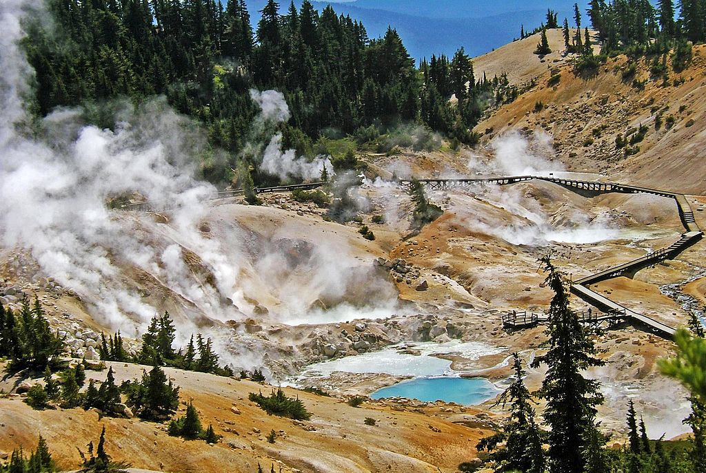
(1 in a multiple picture album) This is NOT taken in Yellowstone. Bumpass Hell is a surprising feature in California's Lassen Volcanic National Park. You hike through pine forests with snow on the ground for some time. Then as you top a hill you look down on this amazing sight. It is named for Kendall VanHook Bumpass (November 6, 1809–1885). He was a miner who found this geothermal site. In 1865, he broke through the surface of a scalding hot mud bank and lost a leg by amputation. |
| Date | |
| Source | Bumpass Hell, Lassen NP 2006 |
| Author | Don Graham from Redlands, CA, USA - God bless it! |
| Camera location | | View this and other nearby images on: OpenStreetMap |
|---|
.jpg¶ms=040.453739_N_-121.446304_E_globe:Earth_type:camera_source:Flickr_&language=en)
Licensing
This file is licensed under the Creative Commons Attribution-Share Alike 2.0 Generic license.
- You are free:
- to share – to copy, distribute and transmit the work
- to remix – to adapt the work
- Under the following conditions:
- attribution – You must give appropriate credit, provide a link to the license, and indicate if changes were made. You may do so in any reasonable manner, but not in any way that suggests the licensor endorses you or your use.
- share alike – If you remix, transform, or build upon the material, you must distribute your contributions under the same or compatible license as the original.
| This image was originally posted to Flickr by inkknife_2000 (5.5 million views) at https://flickr.com/photos/23155134@N06/19841538933. It was reviewed on 7 December 2015 by FlickreviewR and was confirmed to be licensed under the terms of the cc-by-sa-2.0. |
File history
Click on a date/time to view the file as it appeared at that time.
| Date/Time | Thumbnail | Dimensions | User | Comment | |
|---|---|---|---|---|---|
| current | 09:30, 7 December 2015 | | 2,450 × 1,643 (771 KB) | James Allison | Transferred from Flickr via Flickr2Commons |
Pages using this file
The following page uses this file:
.jpg)