File:NPS yellowstone-lake-geologic-map.jpg
Jump to navigation
Jump to search


Size of this preview: 606 × 600 pixels. Other resolutions: 243 × 240 pixels | 485 × 480 pixels | 776 × 768 pixels | 1,035 × 1,024 pixels | 4,508 × 4,460 pixels.
Original file (4,508 × 4,460 pixels, file size: 2.93 MB, MIME type: image/jpeg)
Summary
| Description |
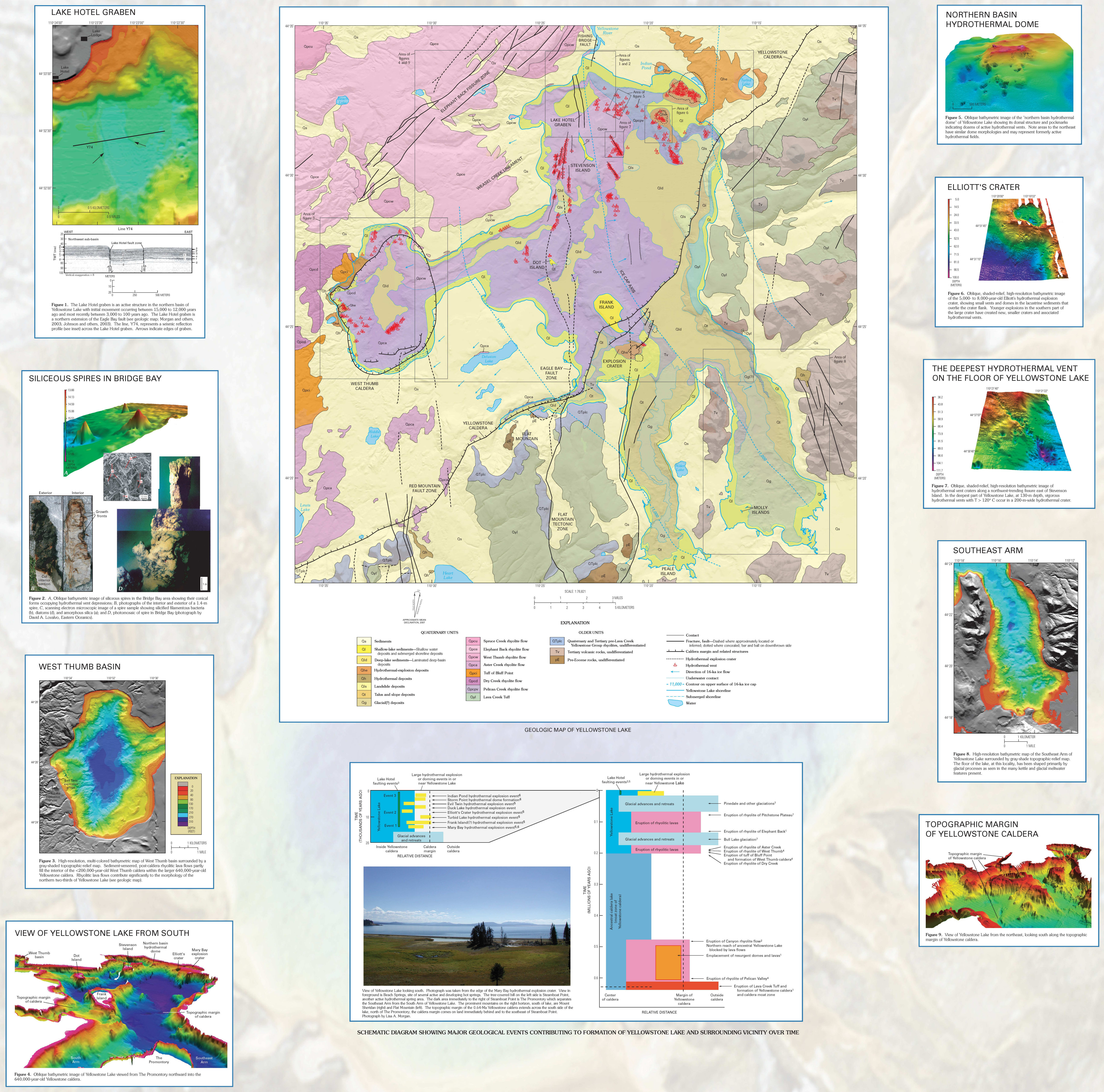
English: This Yellowstone Lake geologic map shows the rock layers underneath Yellowstone Lake and includes inset maps showing points of geological and topographic interest. |
| Date | |
| Source | U.S. National Park Service (http://npmaps.com/wp-content/uploads/yellowstone-lake-geologic-map.jpg) |
| Author | U.S. National Park Service, restoration/cleanup by Matt Holly |
Licensing
| This image or media file contains material based on a work of a National Park Service employee, created as part of that person's official duties. As a work of the U.S. federal government, such work is in the public domain in the United States. See the NPS website and NPS copyright policy for more information. |
File history
Click on a date/time to view the file as it appeared at that time.
| Date/Time | Thumbnail | Dimensions | User | Comment | |
|---|---|---|---|---|---|
| current | 10:13, 17 May 2017 | | 4,508 × 4,460 (2.93 MB) | RKBot | =={{int:filedesc}}== {{Information |description= {{en|1=This Yellowstone Lake geologic map shows the rock layers underneath Yellowstone Lake and includes inset maps showing points of geological and topographic interest.}} |date= 2017-01-21 |source= U.S... |
Pages using this file
The following page uses this file: